Visitors to the remains of the port today, still well preserved with its embankment and quays, inclined planes and road ramp connections, can hardly guess that a river stretching as wide as nearly fifty metres used to run below today’s pedestrian path called “Holy Way”. Here, all sorts of boats from the whole Mediterranean basin would land. Also, a very long structure used to stand behind the embankment, with only three entrances connected to the ramps.
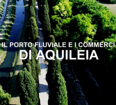
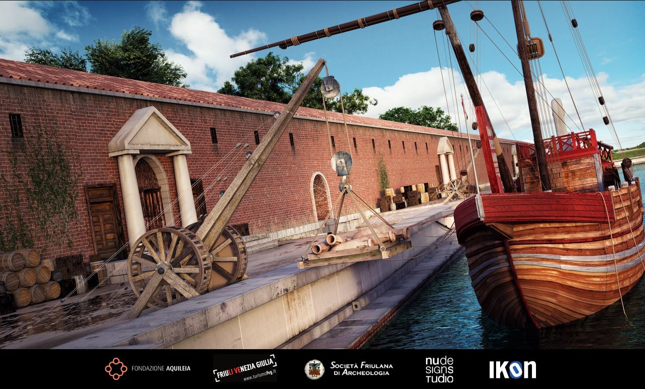
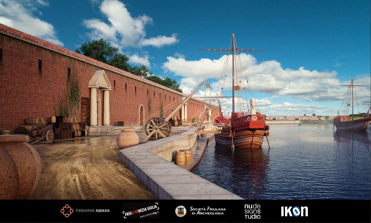
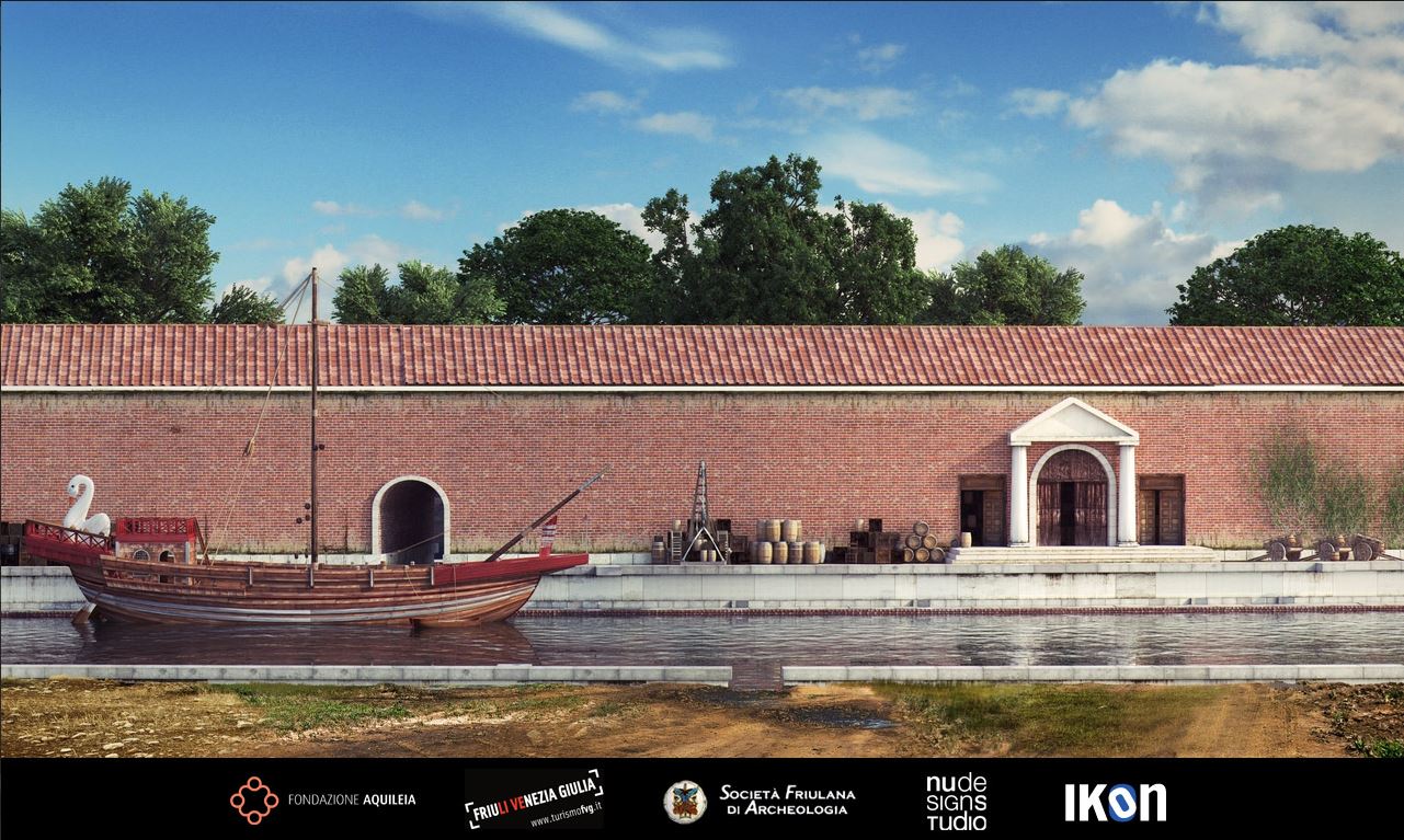
• River port: one of the best preserved examples of port installations of the Roman times was organized on the old course of rivers Natisone and Torre, which flew to the east of the ancient city and widened here up to nearly fifty metres. The port facilities, excavated in the 1930s, stretched for over three hundred metres along the right bank of the river, very close to the Republican walls. Risen above much older installations, the river port was entirely reorganized in the early 1st century AD, with the addition of new quays and a long building opening onto the river. Three ramps would run transverse to the quays to ensure connections with the urban road system. Further changes were brought in at the time of Constantine the Great (306- 337 AD), a few years before the new city walls would be erected on top of the quays. Since then, because of the walls and of the narrowing of the river bed, the port started to be progressively abandoned.
• Quays: they consist of a powerful system of upright limestone slabs surmounted by interlocking parallelepiped blocks, which were used as top loading and unloading floors. Some two metres below the top of the quay, a long walkway helped dockers carry out loading operations in smaller boats. From the lower level, ramps would connect the quays to the city roads, which were also served by wide inclined planes allowing access to the warehouses.
A curio: the walkways sometimes bear small signs of play schemes used by sailors and dockers during free time.
• Mooring loops: today still, the quays show at regular distance some jutting parallelepiped blocks, sometimes rounded off, with a vertical through hole. Experts maintain they may have been used to moor boats or to accommodate wooden cranes to help load and unload cargoes. The lower loading floor used to have horizontal loops, smaller than the former, used to fasten mooring ropes.
• Remains of city walls: the ruins of a sturdy structure some three metres thick are still visible on top of the quays. The structure was added in Late Antiquity (4th century) to the river installations. The river, or what was left of it, supplied another defence to the wall ring, which was also provided with towers. At a later time (probably in the 5th century), a new city ring was added to strengthen the older one, even further into what was left of the river bed.
• Remains of warehouses: a very long edifice was found behind the embankment, whose perimeter brick walls of the long sides remain partly visible. Despite the length, which exceeded three hundred metres, the edifice was quite narrow, that is, no more than thirteen metres wide. The complex, built in the early 1st century AD by demolishing the Republican walls behind it, may have been used as a warehouse to store goods, and it probably encompassed other rooms for offices. Access was granted by at least two gates preceded by a staircase. Probably, the ramps of connection with the city roads used to run below the building. Late in Constantine’s times, the large edifice was enlarged even further: witness thereof comes from the foundations of the pilasters now visible inside and outside the original perimeter.
• Holy Way: it makes a charming archaeological path under cypress trees connecting the river port and the basilica. Created in the 1930s with the backfill of the port excavation works, the itinerary was aimed at creating a symbolic connection – much cherished by the Fascist regime – between the Roman vestiges, the Great War cemetery and the basilica complex, with its extraordinary early Christian heritage.
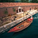
3D Reconstructions